
|
|

   
|
GWN-COGO provides surveyors and civil engineers with comprehensive Coordinate Geometry Software that offers a true database linkage. GWN-COGO ensures the highest level of data integrity, valued by customers such as Orange County, Province of Alberta and other organizations responsible for map production and map data maintenance. The unparalleled flexibility of GWN-COGO makes it an ideal application for a wide variety of projects and allows users to complete any surveying, map production or subdivision design project in minimal time. Feature tables can be custom defined for specific projects or standardized for corporate wide use. Users can choose to work in 2D, 3D or non-graphic mode depending on their preference or project requirements. Distance and angles can be input and maintained in any preferred unit (chain, meter, feet, gradient, chains, etc.). The use of smart dialogue boxes assists users in transferring data into graphic representation quickly and accurately. Our unique "Domino Building Philosophy", which stores each command in an ASCII file, enables users to recreate the entire file at any point with a single keystroke, much like plotting from a CAD program. The value of this is evident when correcting errors, modifying points or executing "what-if" scenarios. By storing data as common ASCII files, it is easily available and adaptable to share with complimentary applications and tools such as GPS collection systems. This open architecture combined with our versatile reporting capabilities ensures the user long-term flexibility as applications evolve and vary. GWN-COGOdb offers, in
addition, a true database linkage, where data is stored in commercial
databases. GWN-COGO provides the highest degree of data integrity. One to one relationship between the data files used by GWN-COGO and the design file, multiple back-up and restore commands, including an option for automatic back-up, and audit file generation ensure data security to satisfy the most demanding users. GWN-COGO stores data in the same way independent of input environment (dialogue boxes, key-ins, batch), which increases consistency and data security. GWN-COGO uses smart dialogue boxes, which handle even complex input. By employing smart dialogue boxes the syntax is done automatically, reducing the time and work needed by users to complete tasks. Additional data input methods offered in GWN-COGO include key-in, graphic selection of elements and batch processing. When using quadrant bearings, data input can be done without leaving the numeric keypad. Large volumes of data are easily downloaded into GWN-COGO with batch processing, which allows the downloading to be done off-line, for example overnight. Data is stored as 3D coordinates with an alphanumeric ID of up to eight characters in length. Figure descriptors may include points or figure IDs (also in combination) up to 1,000 characters in length. Unlimited number of point and figure IDs are allowed. GWN-COGO provides advanced commands for transformations, which enable users to reference data from different sources. The ability to reference data will increase the accuracy of the resulting map or design. With GWN-COGO users can do Affine transformation, Helmut transformation, three axis, scale and offset transformations. Other adjustment commands include compass closure with angular misclosure. Strong graphic integration of GWN-COGO allows coordinate files to be downloaded directly into graphics. Graphics will also be easily recreated when any values are changed.
GWN-COGO's advanced feature
tables enable companies to create corporate wide settings, which can then
be used for each project ensuring uniform quality of design. The overall
flexibility GWN-COGO affords users is also demonstrated by the ability by
users to define:
Flexibility is further increased by GWN-COGO's ability to work in any measurement, whether it be meters, feet, kilometers, miles, gradient or chains. GWN-COGO has been designed with open architecture, which simplifies import and export of data. Integration with other software applications is also made easier. The unique map production
capabilities of GWN-COGO have been designed to enhance platt/map production
making it extremely efficient. GWN-COGO includes a number of sophisticated
cartographic options such as:
GWN-COGO includes a multitude
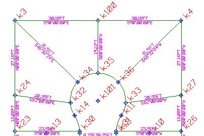
of subdivision design related options, including a number of commands to
create cul-de-sacs, intersections and right-of-ways. These automated commands
greatly simplify the design process enabling civil engineers to complete
projects in shorter time. GWN-COGO also allows users to copy parallel lines,
reducing the number of commands required by users.
Point creation commands also include: GWN-COGO's model based approach and strong graphics integration makes design adjustments effortless and allows users to easily create and change what-ifs. |
|
Copyright © 2003 GWN Technologies International (A Division of Ecosoft System Inc.) |